Surveyor’s Walk
Section 28 · Township 9 South, Range 6 West · Willamette Meridian · Polk County, Oregon
As the surveyor drew it
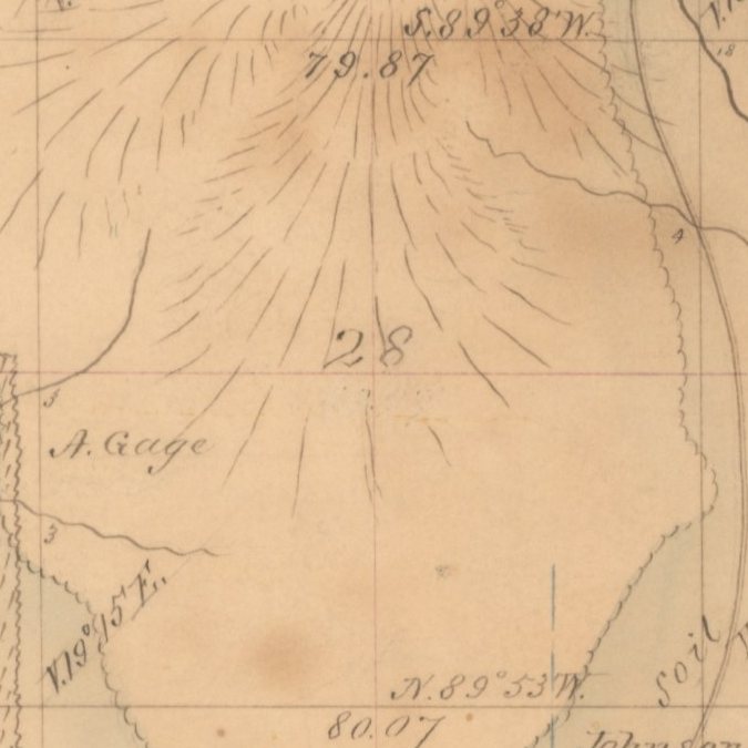
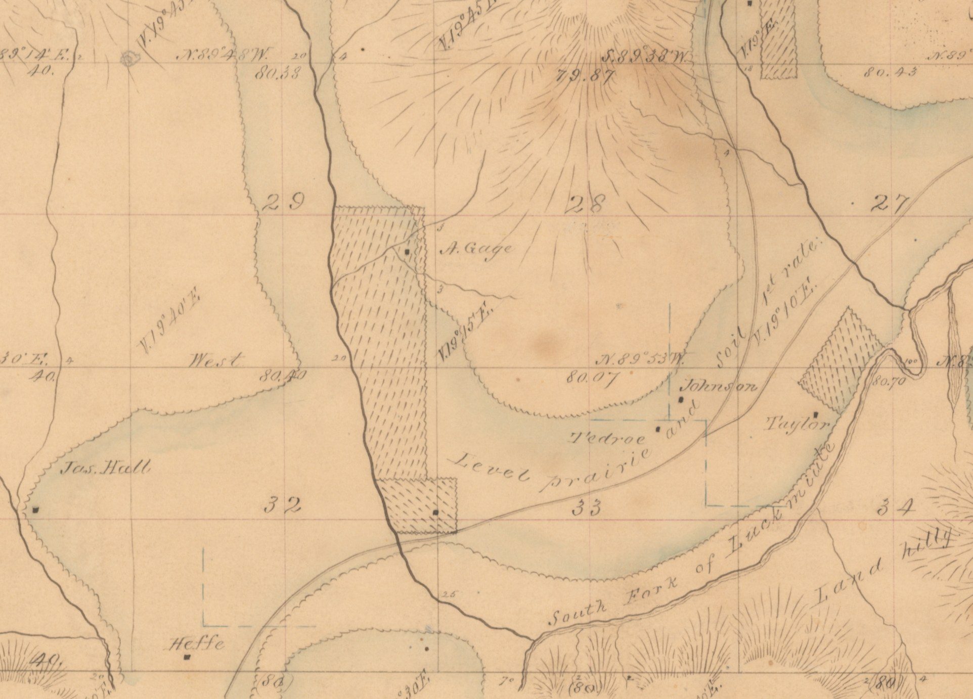
Our drawing of the township
The same ground today
The aerial map needs JavaScript.
USGS aerial imagery. Red: the section’s own pieces. Dashed gold: Donation Land Claims that took the rest.
In the surveyor’s own words
Written by AI Section 28 lies just north of Section 33. Murphy’s 1854 notes for its lines have not been copied out yet, so the surveyor’s own words are still to come. Here is what the 1855 plat and the federal land records show so far.
Look it up yourself
- BLM Oregon/Washington survey records for T9S R6W (plats and field notes, free)
- BLM General Land Office Records (free). In the map search box choose 'Legal Land Description', then type the township and range. For this card, type T9S R6W, Willamette Meridian, Oregon.
Then paste what you find into your folder (start one by finding your land).
Ring the bell
Ask us to prepare this township: we copy out the surveyor’s words by hand and put them on this card. Nobody has asked yet. Be the first.
Also on file for this ground
Facts from the records that are not the surveyor’s own words: patents, entries and figures on the plat.
On the 1855 township plat the line along the top of Section 28 is marked 79.87 and the line along its bottom 80.07. Those are lengths in chains, and 80 chains make a mile (5,280 feet), so the section is close to a mile on a side.
Source: General Land Office township plat, T. 9 S., R. 6 W., approved May 1, 1855. BLM Oregon State Office (figures as the landowner’s history gives them; their places on the lines read from the picture above)
Report an error
In Section 28, Charles W. Pagett received a Homestead Act patent for 104.35 acres on October 12, 1900. A patent is the federal document that passes title out of government hands.
Source: BLM General Land Office Records (land patents), T. 9 S., R. 6 W. (looked up by the landowner; as transcribed in the landowner’s own history of this ground, October 2026)
Report an error
Pagett was not the first to try. BLM’s Historical Index lists three earlier homestead entries on the same tract, made in 1881, 1886 and 1887. All were cancelled, the last in October 1894, and the index names no one.
Source: BLM Historical Index, T. 9 S., R. 6 W. (listed on BLM’s survey records page for the township) (as transcribed in the landowner’s own history of this ground, October 2026)
Report an error
School land
Section 28 is not one of the school-section numbers. Under the federal school-land law for Oregon (1859), Sections 16 and 36 of every township were set aside for schools.
“Sec. 4. And be it further enacted, That the following propositions be, and the same are hereby, offered to the said people of Oregon for their free acceptance or rejection, which, if accepted, shall be obligatory on the United States and upon the said State of Oregon, to wit: First, That sections numbered sixteen and thirty-six in every township of public lands in said State, and where either of said sections, or any part thereof, has been sold or otherwise been disposed of, other lands equivalent thereto, and as contiguous as may be, shall be granted to said State for the use of schools.”
The school sections in this township: Section 16 and Section 36.
Reserved earlier by the 1848 Territorial Act, § 20. Checked against the page image of the official scan.
Claims touching this section
- Donation Land Claim No. 50, about 640 acres
- Donation Land Claim No. 51, about 642 acres
Survey-grid facts: claim numbers and record acres from BLM’s survey grid map.
Sources
- Bureau of Land Management, national survey grid map (CadNSDI): township, section and claim lines
- U.S. Census Bureau geocoder: county and state
- USGS The National Map: aerial imagery
- 43 U.S.C. § 751 (how sections are numbered)
- 11 Stat. 383
- Act of February 14, 1859, ch. 33, § 4, 11 Stat. 383, 383 (35th Cong., 2d Sess.), “An Act for the Admission of Oregon into the Union.”
- General Land Office township plat, T. 9 S., R. 6 W., approved May 1, 1855. BLM Oregon State Office
- BLM General Land Office Records (land patents), T. 9 S., R. 6 W.
- BLM Historical Index, T. 9 S., R. 6 W. (listed on BLM’s survey records page for the township)
Permanent link: https://parcelchronicle-refdesk.drdavesullivan.workers.dev/walk/OR33-T9S-R6W-S28