Surveyor’s Walk
Donation Land Claim No. 53 · Township 9 South, Range 6 West · Willamette Meridian · Polk County, Oregon
As the surveyor drew it
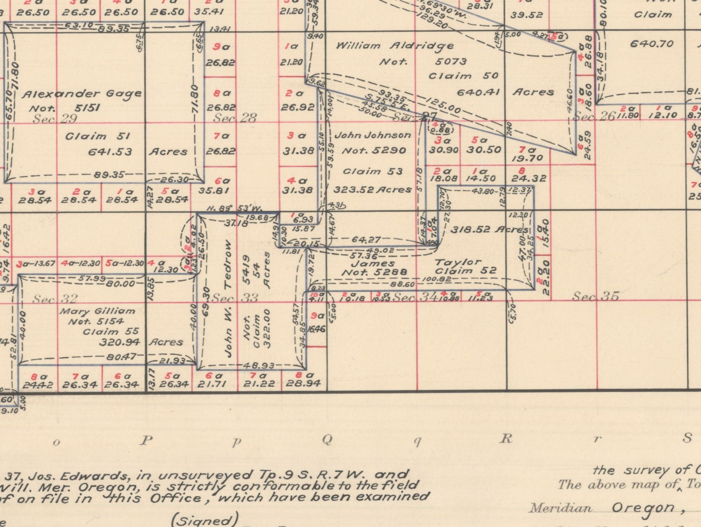
Our drawing of the township
The same ground today
The aerial map needs JavaScript.
USGS aerial imagery. Red: Donation Land Claim No. 53, as the survey grid draws it.
In the surveyor’s own words
Written by AI Donation Land Claim No. 53 was the 323.5 acres of John Johnson. Deputy Surveyor Thomas H. Hutchinson surveyed it on September 14–15, 1855, and found it three fourths prairie and highly improved. From its southwest corner he tied in two houses.
Hutchinson surveyed John Johnson’s 323.5 acres on September 14–15, 1855. His summary: three fourths rich level prairie, one fourth timbered, and highly improved. Johnson even had a “new barn.”
“Three fourths of this claim is rich level prairie, one fourth is timbered. The claim is highly improved.”
Source: Hutchinson, Thomas H. Field notes of the Donation Land Claim surveys, T. 9 S., R. 6 W., 1855. BLM Oregon State Office, vol. D0022 (as transcribed in the landowner’s own history of this ground, October 2026; page not given)
Report an error
Hutchinson tied both houses to one corner, Johnson’s southwest corner: “Tedrow’s house” stood S 40° E, 100 links (66 feet) from it, and “Johnson’s house” N 40° E, about 6 chains (about 396 feet).
“Johnson’s house”
Source: Hutchinson, Thomas H. Field notes of the Donation Land Claim surveys, T. 9 S., R. 6 W., 1855. BLM Oregon State Office, vol. D0022 (as transcribed in the landowner’s own history of this ground, October 2026)
Report an error
Also on file for this ground
Facts from the records that are not the surveyor’s own words: patents, entries and figures on the plat.
The bearing trees at Johnson’s southwest corner were two white oaks, one 546 feet to the southwest and one 189 feet to the northeast.
Source: Hutchinson, Thomas H. Field notes of the Donation Land Claim surveys, T. 9 S., R. 6 W., 1855. BLM Oregon State Office, vol. D0022 (distances as the landowner’s history gives them, in feet; positions approximate)
Report an error
The patent for the Johnson claim was issued in 1877.
Source: BLM General Land Office Records (land patents), T. 9 S., R. 6 W. (looked up by the landowner; as transcribed in the landowner’s own history of this ground, October 2026)
Report an error
School land
Donation Land Claim No. 53 is a claim, surveyed on its own lines rather than as a numbered section. Under the federal school-land law for Oregon (1859), Sections 16 and 36 of every township were set aside for schools. Where a claim lies partly inside one of them, the rules for land settled before the survey decide whether the claim or the school grant held that part. This card doesn’t yet show which sections the claim covers; the school sections in this township are listed below.
“Sec. 4. And be it further enacted, That the following propositions be, and the same are hereby, offered to the said people of Oregon for their free acceptance or rejection, which, if accepted, shall be obligatory on the United States and upon the said State of Oregon, to wit: First, That sections numbered sixteen and thirty-six in every township of public lands in said State, and where either of said sections, or any part thereof, has been sold or otherwise been disposed of, other lands equivalent thereto, and as contiguous as may be, shall be granted to said State for the use of schools.”
The school sections in this township: Section 16 and Section 36.
Reserved earlier by the 1848 Territorial Act, § 20. Checked against the page image of the official scan.
About this claim
Donation Land Claim No. 53 covers 323.53 acres on the record.
Sources
- Bureau of Land Management, national survey grid map (CadNSDI): township, section and claim lines
- U.S. Census Bureau geocoder: county and state
- USGS The National Map: aerial imagery
- 43 U.S.C. § 751 (how sections are numbered)
- 11 Stat. 383
- Act of February 14, 1859, ch. 33, § 4, 11 Stat. 383, 383 (35th Cong., 2d Sess.), “An Act for the Admission of Oregon into the Union.”
- Hutchinson, Thomas H. Field notes of the Donation Land Claim surveys, T. 9 S., R. 6 W., 1855. BLM Oregon State Office, vol. D0022
- BLM General Land Office Records (land patents), T. 9 S., R. 6 W.
Permanent link: https://parcelchronicle-refdesk.drdavesullivan.workers.dev/walk/OR33-T9S-R6W-C53